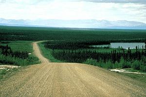
Eighty km northwest of Enterprise, a ferry connects with the highway to Yellowknife, and connecting roads to the east serve Fort Resolution and Fort Smith. The section from Enterprise to Hay River is now a separate highway. First built as an all-weather road, some of its length has been paved. With a total length of about 1200 km, the Mackenzie Highway is the principal highway route into the NWT.
-
- MLA 8TH EDITION
- Morrison, W.R.. "Mackenzie Highway". The Canadian Encyclopedia, 04 March 2015, Historica Canada. www.thecanadianencyclopedia.ca/en/article/mackenzie-highway. Accessed 08 November 2024.
- Copy
-
- APA 6TH EDITION
- Morrison, W. (2015). Mackenzie Highway. In The Canadian Encyclopedia. Retrieved from https://www.thecanadianencyclopedia.ca/en/article/mackenzie-highway
- Copy
-
- CHICAGO 17TH EDITION
- Morrison, W.R.. "Mackenzie Highway." The Canadian Encyclopedia. Historica Canada. Article published June 22, 2009; Last Edited March 04, 2015.
- Copy
-
- TURABIAN 8TH EDITION
- The Canadian Encyclopedia, s.v. "Mackenzie Highway," by W.R. Morrison, Accessed November 08, 2024, https://www.thecanadianencyclopedia.ca/en/article/mackenzie-highway
- Copy
Thank you for your submission
Our team will be reviewing your submission
and get back to you with any further questions.
Thanks for contributing to The Canadian Encyclopedia.
CloseArticle
Mackenzie Highway
Article by W.R. Morrison
Published Online June 22, 2009
Last Edited March 4, 2015
Eighty km northwest of Enterprise, a ferry connects with the highway to Yellowknife, and connecting roads to the east serve Fort Resolution and Fort Smith. The section from Enterprise to Hay River is now a separate highway. First built as an all-weather road, some of its length has been paved.
The Mackenzie Highway, built between 1945 and 1948, originally ran from GRIMSHAW, Alta, through to HAY RIVER, NWT. The highway followed a winter road cut through the bush in the spring of 1939 to Hay River in order to supply the gold fields across Great Slave Lake at YELLOWKNIFE. The majority of the westward section around the southwestern end of Great Slave Lake to Wrigley on the Mackenzie River was built between 1972 and 1976 but was not completed until 1994.

 Share on Facebook
 Share on X
 Share by Email
 Share on Google Classroom


