Article
Toronto Feature: Wesley Building
This article is from our Toronto Feature series. Features from past programs are not updated.
Signing up enhances your TCE experience with the ability to save items to your personal reading list, and access the interactive map.
Create AccountArticle
This article is from our Toronto Feature series. Features from past programs are not updated.
"https://www.thecanadianencyclopedia.ca/images/tce_placeholder.jpg?v=e9dca980c9bdb3aa11e832e7ea94f5d9" // resources/views/front/categories/view.blade.phphttps://www.thecanadianencyclopedia.ca/images/tce_placeholder.jpg?v=e9dca980c9bdb3aa11e832e7ea94f5d9

Article
This article is from our Toronto Feature series. Features from past programs are not updated.
"https://d3d0lqu00lnqvz.cloudfront.net/media/media/e150c523-b139-4758-aa53-6c3ed7d3ec25.jpg" // resources/views/front/categories/view.blade.phphttps://d3d0lqu00lnqvz.cloudfront.net/media/media/e150c523-b139-4758-aa53-6c3ed7d3ec25.jpg

Article
The Toronto Islands, 332 ha, are an archipelago of 15 islands in Lake Ontario about 1.6 km south of downtown Toronto.
"https://d3d0lqu00lnqvz.cloudfront.net/media/media/d6e81d83-d5f3-4859-b3a1-becbd25303b3.jpg" // resources/views/front/categories/view.blade.phphttps://d3d0lqu00lnqvz.cloudfront.net/media/media/d6e81d83-d5f3-4859-b3a1-becbd25303b3.jpg

Article
For much of Toronto’s early history, the dominant cultural force in the predominantly Protestant enclave was church music. By the beginning of the 20th century, Toronto was known as “the choral capital of North America.” By that time, the Toronto Mendelssohn Choir and the Toronto Symphony Orchestra were well established. The city has also been an epicentre of piano building, music publishing, and the English-language recording and broadcasting industries. In addition to classical and choral music, Toronto has been a national centre for jazz artists, folk musicians, rock ‘n’ roll bands and R&B and hip hop artists. The city is home to the headquarters of many major record labels and cultural institutions, as well as some of the country’s oldest and best-known concert halls.
"https://d3d0lqu00lnqvz.cloudfront.net/media/media/de6dd69e-8db5-4371-b208-7e61f4fd3b6d.jpg" // resources/views/front/categories/view.blade.phphttps://d3d0lqu00lnqvz.cloudfront.net/media/media/de6dd69e-8db5-4371-b208-7e61f4fd3b6d.jpg

Article
The Toronto subway is part of a larger public transportation network, including streetcars, buses and light rapid transit, run by the Toronto Transit Commission (TTC). It opened on 30 March 1954, making it Canada’s first subway. Since then, it has grown from a single, 12-station line running 7.4 km beneath Yonge Street to a four-line system encompassing 75 stations over 76.5 km. In 2017, the TTC recorded 213 million passenger trips on the Toronto subway.
"https://d3d0lqu00lnqvz.cloudfront.net/media/home-page-images/a0103c46-7dc7-4df0-b488-fdc41e4de918-resize.jpg" // resources/views/front/categories/view.blade.phphttps://d3d0lqu00lnqvz.cloudfront.net/media/home-page-images/a0103c46-7dc7-4df0-b488-fdc41e4de918-resize.jpg

Article
Tracadie-Sheila, NB, incorporated as a town in 1992, population 4933 (2011c), 4479 (2006c). The Town of Tracadie-Sheila is situated on the Gulf of ST LAWRENCE, 83 km southeast of BATHURST.
"https://www.thecanadianencyclopedia.ca/images/tce_placeholder.jpg?v=e9dca980c9bdb3aa11e832e7ea94f5d9" // resources/views/front/categories/view.blade.phphttps://www.thecanadianencyclopedia.ca/images/tce_placeholder.jpg?v=e9dca980c9bdb3aa11e832e7ea94f5d9
Article
Canada was founded along the many waterways utilized by Indigenous peoples, early explorers, fur traders and pioneers. As Canada became a more developed nation, the automobile and roads began to dominate the landscape. Trails were almost forgotten, except in parks and other protected areas. Today, however, Canadians are using trails in increasing numbers. Trails are either managed by organizations such as parks, municipalities and First Nations, or unmanaged. As of 2010, there were 278,576 km of managed trails in Canada. This distance is roughly the equivalent of traversing the country, from Cape Spear, Newfoundland and Labrador, to the Yukon-Alaska border, 50 times. The province with the largest managed trail network is Quebec. Just over 27 per cent of all managed Canadian trails (77,030 km) are found there.
"https://d3d0lqu00lnqvz.cloudfront.net/media/new_article_images/TrailsAndGreenways/25383146634_544aaeddb9_c.jpg" // resources/views/front/categories/view.blade.phphttps://d3d0lqu00lnqvz.cloudfront.net/media/new_article_images/TrailsAndGreenways/25383146634_544aaeddb9_c.jpg

Article
The Trans-Canada Highway is a continuous road that allows vehicle travel across Canada. The highway runs through each of Canada’s 10 provinces, from Victoria, British Columbia, to St. John’s, Newfoundland and Labrador. At 7,821 km, it is the fourth-longest highway — and second-longest national highway — in the world.
"https://d3d0lqu00lnqvz.cloudfront.net/media/media/eecd2a0a-2457-4b40-b395-ef000ba96c33.jpg" // resources/views/front/categories/view.blade.phphttps://d3d0lqu00lnqvz.cloudfront.net/media/media/eecd2a0a-2457-4b40-b395-ef000ba96c33.jpg

Article
The Trans Canada Trail is over 27,000 km of land and waterways connecting every Canadian province and territory. Construction began in 1992 as part of Canada's 125th birthday celebrations. It was completed 25 years later, in 2017, when Canada turned 150. In 2016, the trail’s name changed to “The Great Trail.” However, in June 2021, the name reverted back to the original.
"https://www.thecanadianencyclopedia.ca/images/tce_placeholder.jpg?v=e9dca980c9bdb3aa11e832e7ea94f5d9" // resources/views/front/categories/view.blade.phphttps://www.thecanadianencyclopedia.ca/images/tce_placeholder.jpg?v=e9dca980c9bdb3aa11e832e7ea94f5d9
Article
The Trent-Severn Waterway system links Lake Ontario (at Trenton) with Lake Huron (at Port Severn on Georgian Bay).
"https://www.thecanadianencyclopedia.ca/images/tce_placeholder.jpg?v=e9dca980c9bdb3aa11e832e7ea94f5d9" // resources/views/front/categories/view.blade.phphttps://www.thecanadianencyclopedia.ca/images/tce_placeholder.jpg?v=e9dca980c9bdb3aa11e832e7ea94f5d9
Article
Trenton, NS, incorporated as a town in 1911, population 2616 (2011c), 2741 (2006c). The Town of Trenton is located on the East River, immediately adjacent to New Glasgow.
"https://www.thecanadianencyclopedia.ca/images/tce_placeholder.jpg?v=e9dca980c9bdb3aa11e832e7ea94f5d9" // resources/views/front/categories/view.blade.phphttps://www.thecanadianencyclopedia.ca/images/tce_placeholder.jpg?v=e9dca980c9bdb3aa11e832e7ea94f5d9
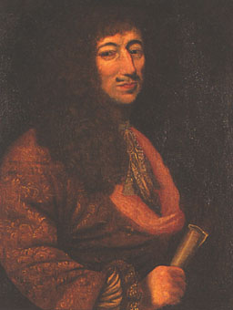
Article
The triangular trade was a trade route connecting France, New France and the West Indies. It was established by France’s comptroller general of finance, Jean-Baptiste Colbert, and applied in Canada in 1667 by Jean Talon, the intendant of New France. The triangular trade enabled New France to diversify its economy and establish its position on the international trade networks.
"https://d3d0lqu00lnqvz.cloudfront.net/media/media/0525a218-565d-4cb9-9eb4-045638ce2140.jpg" // resources/views/front/categories/view.blade.phphttps://d3d0lqu00lnqvz.cloudfront.net/media/media/0525a218-565d-4cb9-9eb4-045638ce2140.jpg
Article
Trinity, NL, incorporated as a town in 1997, population 137 (2011c), 191 (2006c). The Town of Trinity is located on TRINITY BAY in northeast Newfoundland.
"https://d3d0lqu00lnqvz.cloudfront.net/media/media/58774878-3d11-4ee2-9eb0-03b03dad0d66.jpg" // resources/views/front/categories/view.blade.phphttps://d3d0lqu00lnqvz.cloudfront.net/media/media/58774878-3d11-4ee2-9eb0-03b03dad0d66.jpg

Article
Trinity Bay, reputedly named by Gaspar CORTE-REAL on Trinity Sunday, in 1500, is entered between Grates Pt on the N side of Newfoundland's AVALON PENINSULA and the N tip of the Bonavista Pen, 60 km NW, which forms the bay's western shore.
"https://www.thecanadianencyclopedia.ca/images/tce_placeholder.jpg?v=e9dca980c9bdb3aa11e832e7ea94f5d9" // resources/views/front/categories/view.blade.phphttps://www.thecanadianencyclopedia.ca/images/tce_placeholder.jpg?v=e9dca980c9bdb3aa11e832e7ea94f5d9
Article
Trinity College of Music, London. Established in 1872 to provide a comprehensive music education and, through its external examinations department, to examine and award certificates and diplomas (ATCL, LTCL, FTCL).
"https://www.thecanadianencyclopedia.ca/images/tce_placeholder.jpg?v=e9dca980c9bdb3aa11e832e7ea94f5d9" // resources/views/front/categories/view.blade.phphttps://www.thecanadianencyclopedia.ca/images/tce_placeholder.jpg?v=e9dca980c9bdb3aa11e832e7ea94f5d9